Wäsche
Bücher
Postkarten & Sammelbilder
Spielzeug
Uhren
Schmuck
Porzellan
Steingut
Glas
Silber und Metallwaren
Skulpturen & Bronzen
Grafik
Gemälde
Möbel
Münzen
Baustoffe
Zeichnungen, Aquarelle u. Mischtechniken
Sächsische Künstler
Rahmen
Jugendstil
Art deco
Bauhaus
Design ab 1945
Russland
Asiatika
Afrikana
Musikinstrumente
Technik - Lampen - Schreibgeräte
Werbung
Varia - Vermischtes
Jagdliches

Grafik
Lot-No. 3814

.thumbnail.jpg)
.thumbnail.jpg)
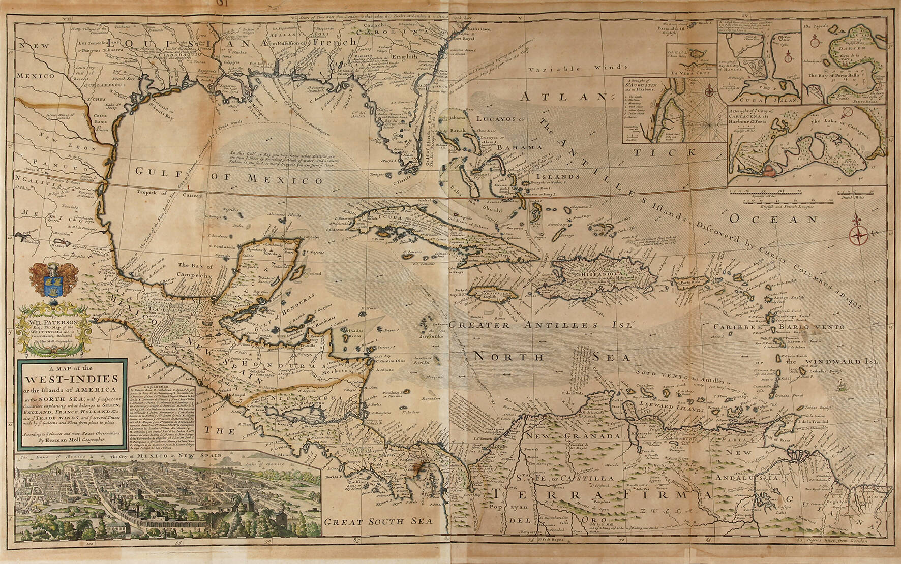
Kupferstichkarte Mittelamerika
in Kartusche bezeichnet „A Map of the West-Indies or the Ilands of Amerika in the North Sea … According to y Newest and most Exact Observations By Herman Moll Geographer“, Darstellung des Gebietes der heutigen Staaten Kuba, Mexiko, Dominikanische Republik, Haiti, Bahamas, Jamaika, Panama, Costa Rica und Honduras sowie Teile von Kolumbien und der Süden der USA, links unten Ansicht von Mexiko-Stadt, Kupferstich mit Grenz- und teilweise Flächenkolorit, Entstehung der Karte um 1715, Abzug des 19. Jh., gebräunt, hinterlegte Einrisse, Darstellungsmaße ca. 59 x 100,7 cm, Blattmaße ca. 63 x 104 cm.
Limit:
250.00 €
Acceptance:
750.00 €
Upcoming events
-
- Einlieferung 123. Auktion
- 2. June 2026 - 25. June 2026
How does an auction work